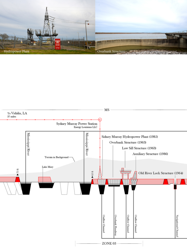
How can one attempt to even begin to truly comprehend the enormous context of trans-boundary challenges besieging the Mississippi River Basin? What is the purpose for us to engage fierce debates about anthropogenic, infrastructural and climate-change impacts on communities, ecologies and industries? How does one both document and map such massive scales, and attempt to make them decipherable to communities in legible ways? Through my practice of field work documentations of the Mississippi River Basin, I have delineated, and by extension shaped, a series of multi-scale orthographic mappings with correlated ground-level photography as a graphic framework to advocate for such debates.
Derek Hoeferlin (with Jess Vanecek, Paul Wu, Chenyu Zhang), Mississippi River Basin Atlas